BULLETIN FORECAST


samedi 12 août 2017

Possible système tropical la semaine prochaine | Possible TC next week


Posez des questions sur tlk.io/nbbcmeteo... Ask questions at tlk.io/nbbcmeteo

Possible système tropical la semaine prochaine | Possible tropical system next week


Rappel: il s'agit de prévisions seulement, voire de "prédictions" basées sur un modèle qui se trompe assez souvent/parfois: GFS (Global Forecast System). Tout comme 99L, ce système pourrait quasiment disparaître avant d'arriver. De plus, aucune météo officielle ne le signale pour le moment.

Reminder: these are forecasts only, or even "predictions" based on a model that is often / sometimes wrong: GFS (Global Forecast System). Just like 99L, this system could almost disappear before arriving. In addition, there are no official weather reports about it at this time. 
Below: Reference image (screenshot on Saturday 12/08 at 14:30 local time). It's a still image, it will not change automatically.

Ci-dessous: image de référence (capturée le samedi 12/08 à 14:30 locale). Image fixe qui ne changera pas automatiquement.


Ci-dessous: Image dynamique (change toutes les 6 heures)
Actuellement, ce système n'existe pas encore et n'existera peut-être jamais... Aucun service météo n'en parle pour le moment y compris le NHC...
On voit l’œil du cyclone passer au nord-est de St Martin aux environs de Samedi prochain.
Cette image sera changée de 6 en 6 h dans les prochains jours. Si ce système naît effectivement, cette image sera remplacée par la trajectoire officielle du NHC.

Below: Dynamic image (changes every 6 hours) Currently, this system does not yet exist and could never exist ... The eye of the cyclone is forecast to pass at northeast of St Martin around next Saturday. This image will be changed every 6 hours. If this system really emerges, this image will be replaced by the official NHC's track.


Capture dans zyGrib (position estimée le 19 août à 4 h)


Posez des questions sur tlk.io/nbbcmeteo... Ask questions at tlk.io/nbbcmeteo

Beau temps jusqu'à demain | Fine weather until tomorrow


METEO...

WEATHER...
SITES OFFICIELS | OFFICIAL WEBSITES: METEO-FRANCE & NHC


  • Fin de la saison cyclonique Atlantique 2017 dans... | End of 2017 Atlantic hurricane season within... 


NOUVEAU ! Numéro Spécial Cyclones du Soualiga Post
Attention, ce document s'avère faux dans sa rubrique " UNE SAISON CYCLONIQUE QUI S’ANNONCE MODÉRÉE" et peut gravement induire en erreur. N'en tenez pas compte! En effet, les affirmations de Météo-France sont anciennes (Avril?) et ne correspondent plus du tout à la réalité (voir les prévisions actualisées plus bas dans cette page)


    UN CYCLONE DANS LE BASSIN ATLANTIQUE ACTUELLEMENT

  1. ATLANTIQUE: 99L actuellement au nord de Porto-Rico. Possibilité de formation pendant les 48 heures ... moyenne ... 60 pour cent. Possibilité de formation dans les 5 jours ... élevée ... 70 pour cent. Voir le NHC. Ce système ne menace pas nos îles ni aucune terre.
  2. Formation de cyclone possible aux alentours de Mercredi entre l'Afrique et les Petites Antilles. Voir le NHC. Ce système pourrait approcher nos îles pendant le weekend (données GFS).
  3. NOUVEAU ! Numéro Spécial Cyclones du Soualiga Post (pdf). INFORMATIONS, CONSEILS, ABRIS
D'AUTRES INFORMATIONS PLUS TARD SUR https://nbbc-news.blogspot.com (si nécessaire)

LIENS:


       ONE TROPICAL CYCLONE IN THE ATLANTIC BASIN CURRENTLY

  1. ATLANTIC: 99L currently north of Puerto Rico. Formation chance through 48 hours...medium... 60 percent. Formation chance through 5 days...high ...70 percent. See NHC.
  2. Possible tropical cyclone formation between Africa and Lesser Antilles around Wednesday. It could approach our islands during the weekend. See NHC.

MORE INFORMATION LATER ON https://nbbc-news.blogspot.com

LINKS:

  • NHC (OFFICIAL) | Tropicaltidbits.com | https://nbbc-news.blogspot.com | NBBCmeteo (cyclone page)
  • https://nbbc-news.blogspot.com
  • Tropical wave, what is it?Tropical Cyclone, what is it?
  • What is an "Invest"?: An invest is an area of disturbed weather for which the NHC is interested in collecting special data, such as microwave satellite imagery and specific model guidance. While the NHC says that designating a disturbance as an invest "does not correspond to any particular likelihood of development of the system into a tropical cyclone," it is generally known that if the NHC designates an invest, that system is of interest to them, and usually has at least a low chance of subtropical or tropical development. The ATCF file system contains specific information for active invests, similar to active tropical cyclones, and that information is displayed below, if available. Lewi Cowan - https://www.tropicaltidbits.com
  • Numéro Spécial Cyclones du Soualiga Post (pdf) (In Fr.): Information, shelters


GO TO THE FULL WEBSITE | ALLER AU SITE COMPLET


SAISON DES CYCLONES | SAISON HUMIDE ET CHAUDE


  ONDES TROPICALES (OT) / CYCLONES:

      1. OT* dans 2-3 jours (Lundi-Mardi)
      2. OT* dans environ 5 jours soit Jeudi.
      3. Possible système tropical pendant le weekend prochain (données GFS)
*OT=Onde Tropicale


METEO LOCALE


Légère dégradation possible Lundi. Sérieuse dégradation possible à partir de mardi soir. Cela pourrait durer jusqu'en fin de semaine. De plus, un cyclone pourrait approcher notre région pendant le weekend.
  • DERNIÈRES 24 H: Beau temps en général parfois très nuageux mais sans averses. Les orages sont restés à distance. Vents faibles le matin se renforçant dans la journée et tombant complètement en soirée. Mer hachée en baie en cours de journée.
  • ACTUELLEMENT: 7 h: Quelques nuages. Orages: aucun à moins de 500 km. Brume de sable: légère (+). Températures: 29ºC (). Humidité: 79% à 7 h (-). Risque de pluie: 20%. Satellite: rares nuages. Radar: RAS. Vents faibles et variables. Mer calme en baie. Houle observée au NBBC: non. Observations 
ATTENTION !
LA CHASSE AUX MOUSTIQUES EST OUVERTE! VIDEZ VOS RÉCIPIENTS D'EAU STAGNANTE Y COMPRIS LES CUVETTES POUR BAINS DE PIEDS ! LA DENGUE EST DE RETOUR!


  • AUJOURD'HUI & DIMANCHE : En général, beau temps chaud avec de faibles risques d'averses peut-être en fin de nuit prochaine. Vents faibles se renforçant dans la journée et mer devenant agitée au large. Demain, peu de changement mais possible légère détérioration dans la nuit de demain.
  • SEMAINE PROCHAINE: Lundi:  quelques averses possibles. Mardi: assez BT. À partir de Mardi soir ou Mercredi, on attend une dégradation qui pourrait être assez sérieuse et durer jusqu'au Samedi suivant. Attention! Possible cyclone aus alentours du weekend.

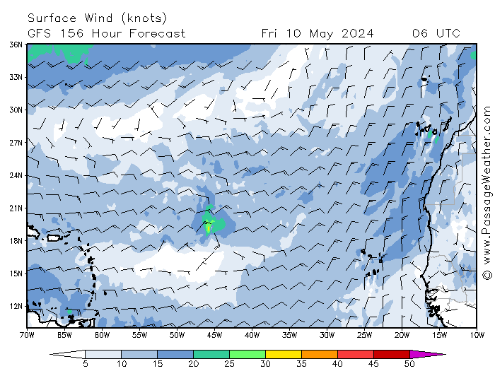
Les îles du Nord sont en haut à droite. Prévisions pluies automatiques GFS de 12 en 12 h dans les 2 jours (pas garanties du tout!). Cliquez sur les images pour les agrandir. Heures UTC (retirer 4 h pour l'heure de St Martin) | Anguilla, SXM and St Barth are at top right. Two days GFS automatic rain forecasts interval of 12 h (not guaranteed at all). Click on images to enlarge. UTC hours (subtract 4 hours for St Martin time)

12 - 24 - 36 - 48 h


  • BRUME DE SABLE SAHARIENNE: légère ()
  • VENTS, MER & HOULE
    • Vents et Mer: Température de l'eau au large: 28-29ºC. Voir les météos officielles: meteofrance.gp (en) | Côtier Îles du Nord (french) | Anguilla (en) | Autres meteo.
    • Houle primaire: ENE, 9 s (=), 1,2 (-).

  • DERNIÈRE MINUTE (): RAS

      Messagerie instantanée de NBBCmeteo...  Si vous recevez ces bulletins par email, allez sur le site pour profiter pleinement de cette page...
      *OT= Onde Tropicale; Talweg: creux de surface (généralement orientés nord-sud ou à peu près). Toutes les heures sont locales c-à-dire AST (Atlantic Standard Time) excepté parfois certaines cartes et graphiques (UTC).


      HURRICANE SEASON | WET & WARM SEASON

       
        TROPICAL WAVES & CYCLONES
       

      1. TW* on Monday
      2. TW from Wednesday or Thursday.
      3. A Tropical Cyclone could form midweek and approach our islands during the weekend (GFS data)


      *TW=Tropical Wave


      LOCAL WEATHER


      Slight degradation possible Monday. Serious degradation possible from Tuesday evening or Wednesday. This could last until the weekend. In addition, a tropical cyclone could form midweek between Africa and Lesser Antilles and affect our region during the next weekend (above).

      • LAST 24 H: Fairly good weather. Low to moderate winds with a few strong gusts. Choppy sea in the bay during the day. History & observations.
      • CURRENTLY: (7h) A few clouds. Dust haze: slight (+). Chance of morning showers: 20%. Temperature: 29ºC | 84ºF (). Humidity: 79% (). Satellite: (See above in french forecast): few clouds. Radar: NTR. Thunderstorms: None at less 300 mi. Winds: Low and variable. Bay: calm. Swell: no significant swell observed here. Observations


      CAUTION ! 
      HUNT MOSQUITOES! EMPTY CONTAINERS OF STANDING WATER INCLUDING THE BOWLS. DENGUE FEVER IS COMING BACK.


      • TODAY & TOMORROW: Fairly good and hot weather. Chance of rain is 20% at this time. Chance  of rain could slightly increase late night. Low to moderate winds increasing during the day hours. Slight to moderate seas. Tomorrow: little change. Possible slight deterioration during the night.
      • NEXT WEEK (not sure): Monday, possible showers and thunderstorms maybe. Tuesday, fairly good weather. From the night or Wednesday, we expect a fairly serious deterioration that could last until until Saturday. Lot of clouds, showers and possible thunderstorms. Possible tropical cyclone during the weekend.
      • WINDS, SEAS & SWELL (3 days): Water temp: 29ºC | 84º F (-). See official weather services: meteofrance.gp (english) | Coastal Îles du Nord (french) | Anguilla (en) | Other met offices.
      • Swell: ENE, 9 s (=), 4 ft (-) or 1.2 m.


      • LAST MINUTE (): NTR


       Ask questions on NBBCmeteo Chat... Easy! Just one click to talk...You can also try the chat box at bottom of this page (not in emails). If you receive these bulletins by email, go to the whole site to fully enjoy this page .. All hours are in local time or AST (Atlantic Standard Time) except some maps and charts (UTC).


Note
:
  les probabilités de pluie peuvent changer d'une heure à  l'autre. Vérifiez-les | Rain chance may change from hour to hour. check it out Les prévisions détaillées sont maintenant en début de bulletin | Detailed forecasts are now at the beginning of the bulletin (above). Une page réunissant automatiquement toutes les observations va être complètée bientôt | A page automatically gathering all the observations will be completed soon


 CYCLONES TROPICAUX | TROPICAL CYCLONES


Surveillance Atlantique | Monitoring Atlantic

Clic sur les images pour les agrandir | Click images to enlarge

Prévisions vent Atlantique de 36 à 180 h ( 1,5 à 7,5 j) 18 h UTC | Winds forecast Atlantic from 36 to 180 h (1.5 to 7,5 d). 18 UTC


Surveillons les Caraïbes | Monitoring Caribbean

Prévisions vent Caraïbes de 24 à 168 h (1 à 7 j) 6 h UTC |  Winds forecast Caribbean from 24 to 168 h (1 to 7 d) 6 UTC


Position St Martin sur les cartes ci-dessous | St. Martin location on the maps above


Clic sur l'image pour aller à l'animation | Click on image to go to the loop


LINKS-LIENS


APPLICATIONS POUR MOBILES - MOBILE APPS


Application pour Smartphone et Iphone
L'application CapCap (ou Cap.Cap) est conçue pour plusieurs îles des Caraïbes dont St. Maarten et Anguilla et peut être mise en Français. Elle semble bien fonctionner (1 alerte/test par mois)

J'ignore s'il existe pour d'autres téléphones et pour PC

Application for Smartphone and Iphone

The CapCap application is designed for several islands including Sint Maarten. It seems to work well (1 alert / test per month)
For Smartphone / Android Tablet: https://play.google.com/store/apps/details?id=hr.optimit.capcap.mobile
For Iphone / Ipad: https://itunes.apple.com/us/app/capcap/id1176568291

I do not know if it exists for other phones OS neither for PC

Voir aussi
Atlantic Ocean Tsunami Alerter (Android seulement), un simple widget (très) invisible et (très) discret. Se manifeste seulement en cas de menace semble-t-il (pas sûr qu'il fonctionne toutefois. J'ai quelques inquiétudes...)

Mobile Apps & sites: