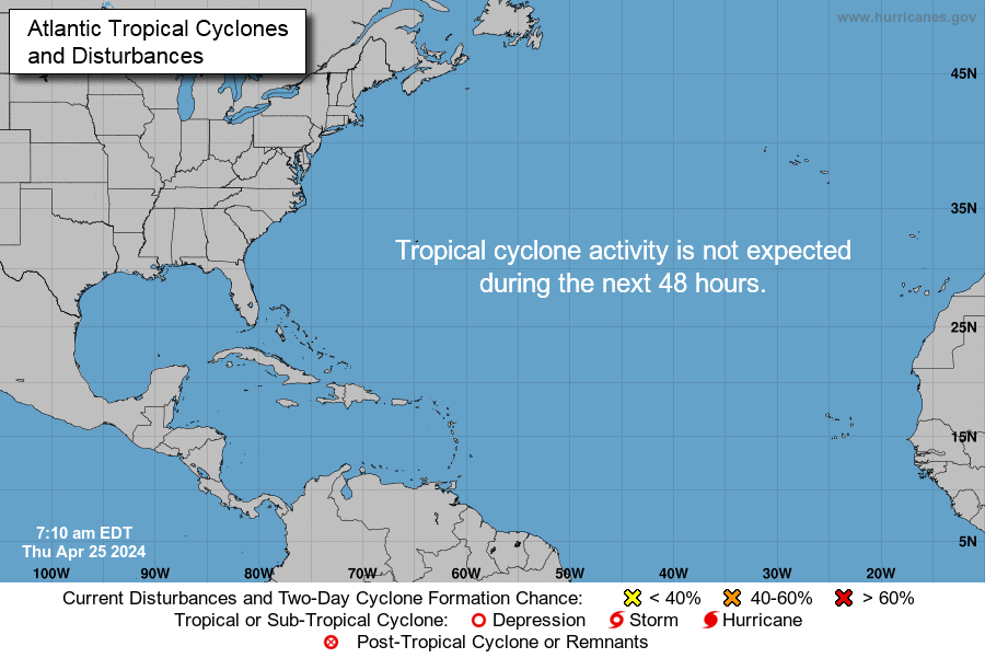
CYCLONES
Nous sommes arrivés au pic de la saison cyclonique. Actuellement, il y a 3 cyclones actifs, tous plus ou moins proches de l'Amérique du Nord. Ils ne menacent aucunement notre région. Par contre, un système près de l'Afrique nous donne quelques (petites) inquiétudes. Pour le moment, cependant, il n'est pas au mieux de sa forme et a même perdu récemment sont statut d'Invest. Il pourrait arriver Lundi prochain. Il faut donc rester vigilant.
We have almost reached the peak of the hurricane season. Currently there are 3 active Tropical Cyclones, all more or less close to the North America. They doesn't threaten our region. By cons, a system closer to Africa gives us some (light) worries. For now, however, it is not in good shape and has even lost its status of Invest recently. It could arrive next Monday. We must therefore remain vigilant.
Atlantique Nord tropical d'Hispaniola à l'Afrique... North Tropical Atlantic from Hispaniola to Africa
POSSIBLE TROPICAL STORM ON NORTHERN LESSER ANTILLES EARLY NEXT WEEK
A broad area of low pressure, associated with a tropical wave, is located over the far eastern Atlantic near the Cabo Verde Islands. This wave is in an environment of very dry air, which should prevent any significant development for a few days. Some development is possible over the weekend when the wave nears the Lesser Antilles.
- Formation chance through 5 days...medium...40 %
COMMENTS...
The chance of formation has diminished (40% chance of development instead of 60% - 2 days ago). However, sooner or later, this system should develop, perhaps just before reaching our region within about 5 days. Currently, the system has lost its status of "invest". Therefore estimated path maps are no more updated.
OTHER TROPICAL CYCLONES
- Hurricane Gaston: North Atlantic. Weakening. could threaten the Azores Archipelago as Tropical Storm.
- Tropical Depression Eight: Off US East Coast. Strengthening into TS. No threat to any land
- Tropical Depression Nine: Mexico Gulf. Strengthening into TS. Threats: From northern Florida to North Carolina (coasts)
Next cyclone names: Hermine, Ian & Julia
CYCLONE POSSIBLE EN DÉBUT DE SEMAINE PROCHAINE SUR LE NORD DES PETITES ANTILLES
Une large zone de basse pression, associée à une onde tropicale, est située sur l'extrême-Est Atlantique, près des îles du Cap Vert. Cette Onde est dans un environnement d'air très sec, ce qui devrait empêcher tout développement significatif pendant quelques jours. Un certain développement est possible pendant le week-end lorsque l'Onde va se rapprocher des Petites Antilles.
- Chances de formation dans les 5 jours... moyennes... 40%
COMMENTAIRES...
L'inquiétude est moins grande qu'il y a 3 jours car les chances de formation ont bien diminué (40% de chances de formation au lieu de 60% il y a 3 jours). Cependant, tôt ou tard ce système devrait se former, peut-être juste avant d'aborder les Petites Antilles. Ce système devrait atteindre notre région dans environ 5 jours. Actuellement, il a perdu son statut de "invest". Nous ne disposons donc plus actuellement de cartes de trajectoires.
AUTRES CYCLONES
- Ouragan Gaston: Atlantique nord. Pourrait menacer les Açores vendredi comme Tempête Tropicale.
- Tropical Depression Eight: Au large de la côte Est US. Ne menace plus aucune terre. Se renforce en Tempête Tropicale.
- Tropical Depression Nine: Golfe du Mexique. Renforcement en Tempête Tropicale bientôt. Menace: Nord-Floride à la Caroline du Nord (côtes).
Prochains noms de cyclones: Hermine, Ian puis Julia
SVP, RÉFÉREZ-VOUS AUX MÉTÉOS OFFICIELLES !
PLEASE, STAY TUNED TO OFFICIAL WEATHER OFFICES!
Autres cyclones | Other cyclones
St Martin est exactement au centre | St Martin is exactly in the center
METEO
L'Anticyclone domine actuellement ce qui pourrait renforcer les Alizés et apporter de la brume de sable. Un faible talweg est en approche. Une onde tropicale devrait arriver autour de vendredi. De samedi à Mardi, une sérieuse détérioration du temps est possible avec l'arrivée d'un système tropical. Si ce système passe plus au nord, nos îles pourraient être seulement marginalement affectées voire pas du tout.
- Hier & nuit dernière: assez beau temps assez nuageux et très brumeux. Rares et faibles averses.
- Actuellement: partiellement nuageux et légèrement brumeux (brume de sable saharienne). Vents modérés avec rafales. Clapot (=vagues courtes et cassantes) en baie.
- Aujourd'hui, Mercredi, on prévoit un assez beau temps un peu brumeux avec de faibles chances d'averses. Les vents sont modérés mais de fortes rafales sont possibles (60 km/h) sous grains. La mer devrait être agitée ou très agitée en Atlantique. Mer agitée en Baie.
- Jeudi & Vendredi: Partiellement nuageux à parfois très nuageux avec des chances accrues d'averses et peut-être même des orages. Vents et mer: renforcement. Fortes rafales possibles 60 km/h.
- Samedi à Mardi: Approche d'un système tropical. Les chances de fortes pluies et orages augmentent. Des inondations soudaines et dangereuses sont possibles. Les vents se renforcent 30 à 45 km/h voire plus. La Mer devient très agitée à forte. Si ce système passe bien au nord: beau temps.
- Fin de semaine prochaine: nouvelle détérioration du temps possible
VENTS et MER: VENTS FORTS ET MER FORTE POSSIBLES À PARTIR DE LA NUIT DE SAMEDI AU NORD DE LA GUADELOUPE (NORD DE 16N)
Southwest Tropical North Atlantic & Caribbean Sea (OFFNT3)
SEAS GIVEN AS SIGNIFICANT WAVE HEIGHT...WHICH IS THE AVERAGE HEIGHT OF THE HIGHEST 1/3 OF THE WAVES. INDIVIDUAL WAVES MAY BE MORE THAN TWICE THE SIGNIFICANT WAVE HEIGHT.
Synopsis for the Caribbean Sea & Tropical North Atlantic from 7°N to 22°N
AMZ001-312115-SYNOPSIS FOR CARIBBEAN SEA AND TROPICAL N ATLANTIC FROM 07N TO 19N BETWEEN 55W AND 64W
514 AM EDT WED AUG 31 2016
- SYNOPSIS...HIGH PRESSURE RIDGE BUILDING W ALONG 24N WILL SUPPORT FRESH TO STRONG TRADES IN THE SOUTH CENTRAL CARIBBEAN THROUGH FRI...WITH MODERATE TRADES EXPECTED ELSEWHERE. A STRONG TROPICAL WAVE IN THE EASTERN ATLANTIC WILL REACH THE TROPICAL N ATLANTIC SAT...WITH HIGH WINDS AND SEAS POSSIBLE N OF 16N.
AMZ025 Zone Forecast
AMZ025-312115-OFFSHORE WATERS LEEWARD ISLANDS
514 AM EDT WED AUG 31 2016
- TODAY...NE TO E WINDS 15 TO 20 KT. SEAS 5 TO 7 FT.
- TONIGHT...E WINDS 15 TO 20 KT. SEAS 5 TO 7 FT.
- THU...E WINDS 15 TO 20 KT. SEAS 4 TO 6 FT. SCATTERED SHOWERS AND ISOLATED TSTMS.
- THU NIGHT...E WINDS 15 TO 20 KT. SEAS 4 TO 6 FT.
- FRI...NE TO E WINDS 15 TO 20 KT. SEAS 4 TO 6 FT.
- FRI NIGHT...NE TO E WINDS 15 TO 20 KT. SEAS 5 TO 7 FT.
- SAT...NE TO E WINDS 15 TO 20 KT. SEAS 5 TO 7 FT.
- SAT NIGHT...NE TO E WINDS 20 TO 25 KT. SEAS 6 TO 8 FT.
- SUN...E WINDS 20 TO 25 KT. SEAS 8 TO 11 FT.
- SUN NIGHT...SE WINDS 20 TO 25 KT. SEAS 8 TO 11 FT.
FORECASTER MUNDELL
Mise-à-jour: http://www.nhc.noaa.gov/marine/offshores.php
Plus d'informations sur le site (cliquer sur MER SEA)
|
1 kt (knot)=1 nd (nœud)=1,852 km=1.15 miles
1 ft (foot)=1 pi (pied)=0,3048 m
Plus de détails sur le site (cliquer sur MER SEA)
NOTES:
- Les prévisions au-delà de 5 jours ne sont pas garanties
- Seules les houles de nord-ouest et parfois de NNE peuvent affecter les plages du NBBC
ONDES TROPICALES
- Faible talweg dans moins de 36 h
- Onde tropicale modérée dans 2-3 jours (Vendredi-Samedi)
- Onde tropicale vigoureuse + système tropical autour de lundi prochain
TROPICAL WAVES
- Weak trough within less 36 h.
- Moderate tropical wave within 2-3 days (Friday-Saturday)
- Strong TW + possible Tropical Cyclone early next week.
WEATHER
The high-pressure system currently dominates the region. It could strengthen the trade winds and bring sandy haze. A weak trough is expected to arrive around Friday followed by a moderate Tropical Wave (Saturday). Showers and thunder are possible. From Sunday, a serious deterioration is possible with the arrival of a Tropical System. If this system goes further north, our islands would be affected only marginally or not at all.
- Yesterday & night: fairly good weather. Rare and light showers.
- Currently: Mostly sunny and slightly hazy (Saharan sand dust). Moderate gusty winds. Choppy waves in the bay.
- Today, Wed, expected fairly good weather with a light chance of passing showers. Winds strengthen 15-20 kts and strong gusts are possible. Seas become moderate in Atlantic 6 ft. Slight & choppy waves in the bay.
- Thursday-Friday: Partly cloudy to cloudy with increasing chance of showers and thunder maybe. Winds and seas: possible strengthening. Possible strong gusts 30-40 mph.
- From Sunday to Tuesday Sept. 6th, a serious deterioration is likely as a Tropical System is expected to approach our islands. Heavy showers could trigger flash floods. Thunderstorms possible. Fresh to strong gusty winds. Rough seas. If it moves further north, rather good weather is expected.
- Next week: possible new détérioration around Friday.
- WINDS & SEAS: Go to website (click on MER SEA) or below. HIGH WINDS AND SEAS POSSIBLE NORTH OF GUADELOUPE (16N) FROM SATURDAY NIGHT.
Southwest Tropical North Atlantic & Caribbean Sea (OFFNT3)
SEAS GIVEN AS SIGNIFICANT WAVE HEIGHT...WHICH IS THE AVERAGE HEIGHT OF THE HIGHEST 1/3 OF THE WAVES. INDIVIDUAL WAVES MAY BE MORE THAN TWICE THE SIGNIFICANT WAVE HEIGHT.
Synopsis for the Caribbean Sea & Tropical North Atlantic from 7°N to 22°N
AMZ001-312115-SYNOPSIS FOR CARIBBEAN SEA AND TROPICAL N ATLANTIC FROM 07N TO 19N BETWEEN 55W AND 64W
514 AM EDT WED AUG 31 2016
- SYNOPSIS...HIGH PRESSURE RIDGE BUILDING W ALONG 24N WILL SUPPORT FRESH TO STRONG TRADES IN THE SOUTH CENTRAL CARIBBEAN THROUGH FRI...WITH MODERATE TRADES EXPECTED ELSEWHERE. A STRONG TROPICAL WAVE IN THE EASTERN ATLANTIC WILL REACH THE TROPICAL N ATLANTIC SAT...WITH HIGH WINDS AND SEAS POSSIBLE N OF 16N.
AMZ025 Zone Forecast
AMZ025-312115-OFFSHORE WATERS LEEWARD ISLANDS
514 AM EDT WED AUG 31 2016
- TODAY...NE TO E WINDS 15 TO 20 KT. SEAS 5 TO 7 FT.
- TONIGHT...E WINDS 15 TO 20 KT. SEAS 5 TO 7 FT.
- THU...E WINDS 15 TO 20 KT. SEAS 4 TO 6 FT. SCATTERED SHOWERS AND ISOLATED TSTMS.
- THU NIGHT...E WINDS 15 TO 20 KT. SEAS 4 TO 6 FT.
- FRI...NE TO E WINDS 15 TO 20 KT. SEAS 4 TO 6 FT.
- FRI NIGHT...NE TO E WINDS 15 TO 20 KT. SEAS 5 TO 7 FT.
- SAT...NE TO E WINDS 15 TO 20 KT. SEAS 5 TO 7 FT.
- SAT NIGHT...NE TO E WINDS 20 TO 25 KT. SEAS 6 TO 8 FT.
- SUN...E WINDS 20 TO 25 KT. SEAS 8 TO 11 FT.
- SUN NIGHT...SE WINDS 20 TO 25 KT. SEAS 8 TO 11 FT.
FORECASTER MUNDELL
Mise-à-jour: http://www.nhc.noaa.gov/marine/offshores.php
Plus d'informations sur le site (cliquer sur MER SEA)
|
1 kt (knot)=1 nd (nœud)=1,852 km=1.15 miles
1 ft (foot)=1 pi (pied)=0,3048 m